
Printable UTM Guide PDF
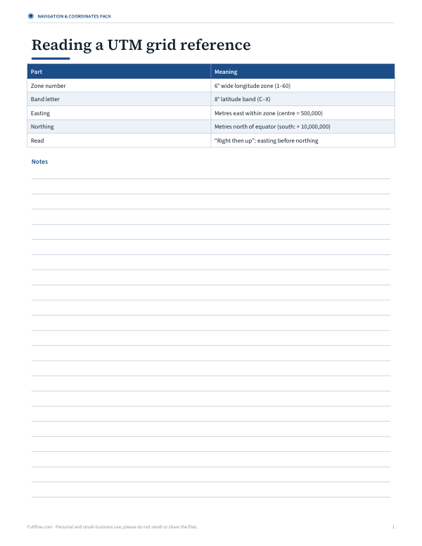
This 1-page UTM guide is for anyone reading map coordinates, checking a grid reference, or learning the parts of a UTM location. It shows a simple table with columns for Part and Meaning. The rows explain zone number as a 6° wide longitude zone from 1 to 60, band letter as an 8° latitude band from C to X, and easting as metres east within the zone, with the center at 500,000.
Free printable · PDF
- 1 page
- US Letter — choose “Fit to page” for A4
- PDF, 59 KB
Free for personal, family and classroom use.
Use it as a quick reference while working with maps, field notes, or coordinate lookups. Start with the zone number, then match the band letter, and finish by checking the easting value. Keep the sheet nearby when you need a clear reminder of what each part of a UTM grid reference means.
Good for
- Reading UTM grid references
- Learning coordinate parts
- Checking map location details
Tip: Print it on letter paper and keep it with your map or field notebook.
4 files · PDF, DOCX, XLSX
Get every sheet: Navigation & Coordinates Pack
This sheet plus 3 more in one download, with the editable Word and Excel files. Printable coordinate format cheat sheet, a DMS–decimal conversion table, a waypoint log for hikes and geocaching (Excel), and a UTM grid reference guide.
$3.00 USD, one-time 4 files · about $0.75 each
- Instant download
- 7-day refund
- Secure checkout by Stripe
7-day money-back guarantee. Full refund within 7 days of purchase, even after you download.
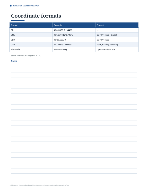 Printable Coordinates Formats Cheat Sheet
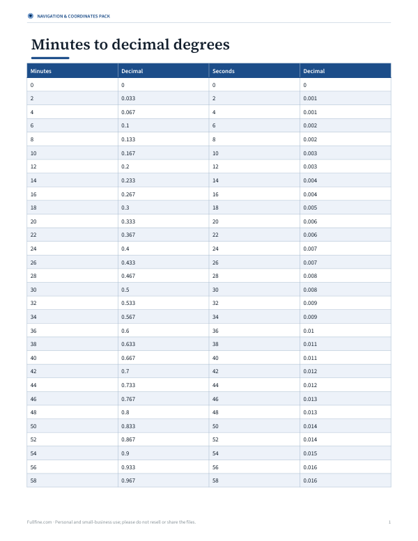 Minutes to Decimal Degrees Chart
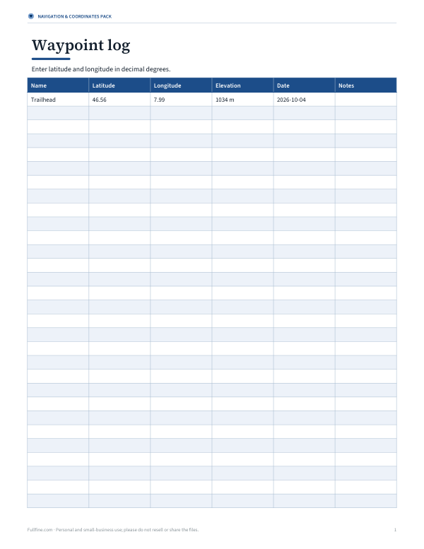 Printable Waypoint Log Sheet